

This article is Part Three of a three-part series about my 5,000-mile sabbatical road trip in an EV from my home in the southern Appalachians to the island of Newfoundland, and my reflections on what it means to be citizens and climate advocates as the planet overheats. Part One can be found here, and Part Two here.
With late morning sunlight streaming through the smudged windshield, we cross the Saint Croix River and approach the Canada Border Services checkpoint. I roll down the window, passports in hand. “Bonjour,” says the officer from his booth. I turn to my wife. “Well,” I say, “I hope you brushed up on your high school French.” I hand the border agent our passports and answer the dozen questions he rattles off, effortlessly switching from French to English, his businesslike manner suggesting he’s done this a thousand times before. After we satisfy him with our answers, he waves us through with a slight smile. “Welcome to Canada. Enjoy your stay.”
As we drive into New Brunswick, the highway we’ve driven for 1,200 miles turns unfamiliar; miles become measured in kilometers, the speed limit drops, slowing the fast pace of the past three days, everything is written in French and English, and we can’t decipher the iconography on the blue road signs trying to tell us what services are ahead. We change the settings on our EV’s screen to display everything in kilometers; we don’t want to be those dumb Americans whose EV battery dies on the side of the road because we didn’t do the kilometers-to-miles math right. We set the cruise control to the posted speed limit to ensure my lead foot doesn’t get us in trouble, and we start playing the “guess what that icon is” game. Neither one of us can figure out what the old-timey key, fiddlehead, or waving stick family in the barn symbolize.
Two hours later, we arrive at our inn in St. Martins on the Bay of Fundy. I step out of the car, and the stiff ocean breeze tickles my bald head, giving me goosebumps. We walk up onto the wide front porch of the white colonial house, the sound of a man singing and playing piano pouring out of the open front door. We step inside and greet the innkeeper, tapping on his desk to the rhythm of the music entertaining guests in the inn’s parlor. A waitress excuses herself as she squeezes behind me and my suitcase, glasses full of beer balanced on a cocktail tray. We check in and ask him if there is an external wall outlet we can plug the EV into overnight before driving remote coastal roads into Fundy National Park. He takes me behind the inn and points to a leaning 2×4 post with a Medusa-like head of wires. “That’s where we plug in our septic pump,” he says. “You can plug in there. Just don’t get your tires too close, or your car might fall into the tank.” Unsure if he’s joking, I back up nervously to where I can just reach the outlet with our long charging cord. After ten minutes on my knees at the post trying to plug our charger in amid the entanglement of other plugs competing for the last open socket, I succeed, and our EV starts drawing power.
The next morning I unplug the cord. The EV is fully charged and not in the septic tank. We drive a few miles down the road and turn onto the Fundy Trail Parkway. The tight two-lane road twists and turns as we climb onto the 800-foot cliff wall that lines this part of Fundy Bay. I roll down the windows to let the cool morning coastal air wash away the days of high-speed highway driving that are behind us. As we approach Fownes Head, the trees on the right side of the road give way to tan rock-encrusted ground and a view of the shimmering bay. I pull into the lookout parking lot. We are the only ones here. We walk the short trail onto the lookout’s deck platform and peer over the edge of the railing. The bay gently sloshes against golden cliffs and ragged sea stacks that look like giant rock cairns stacked by the Gods. A lone black spruce tree grows triumphantly on top of the biggest stack. Thirty miles of undeveloped, rugged coastline stretches out before my eyes. I look through the monocular and, in the distance, spot what I think is Point Wolfe in Fundy National Park, where we will camp the next three nights. I hug my wife from behind and whisper in her ear, “This was worth the drive.”
Chasing Climate Innovation on the Bay of Fundy
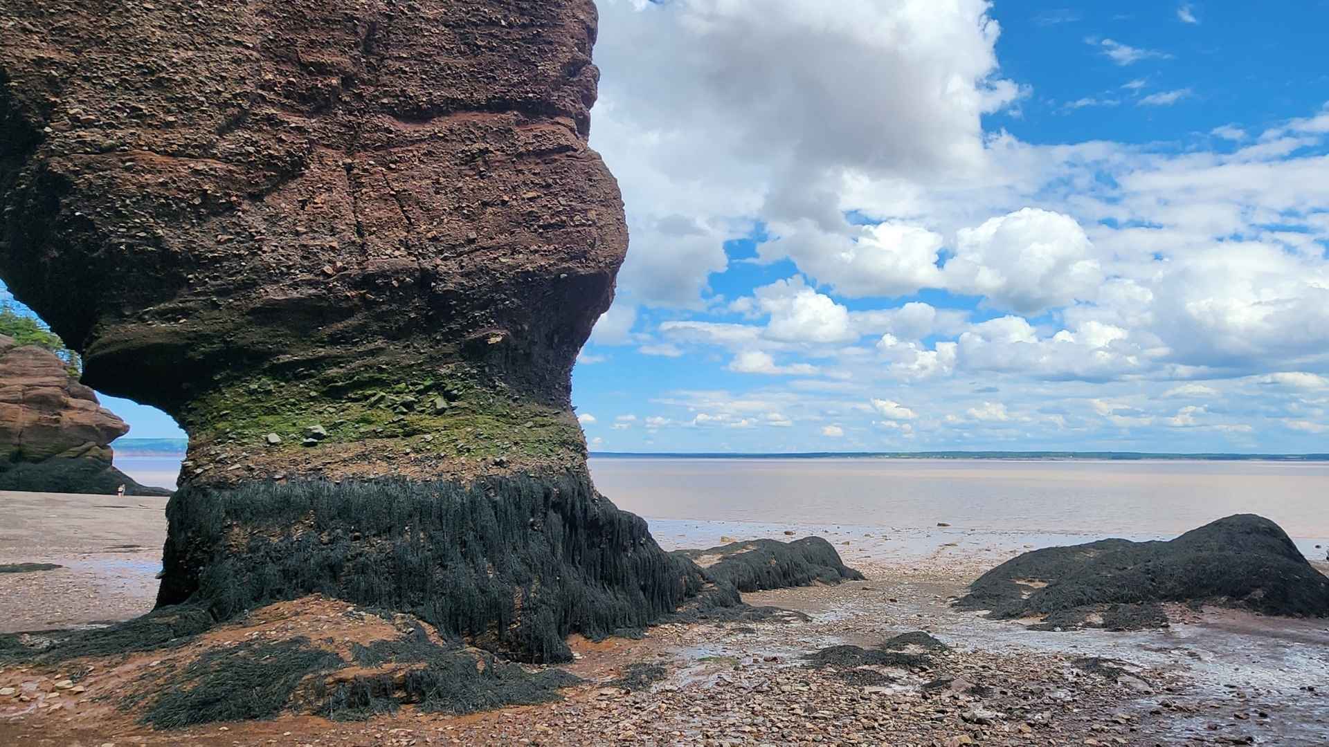
The first Canadian leg of our journey to Newfoundland took us along the Bay of Fundy, which is sandwiched between New Brunswick’s southern and Nova Scotia’s northern coastlines. The bay is globally distinctive for having the highest tidal range in the world: it rises and falls over 50 feet with every six-hour tidal change as roughly 176 billion tons of seawater rushes in and out of it—more than the combined flow of all the world’s freshwater rivers during that same six-hour window. These massive tidal changes are the result of the shape and slope of the bay, and its interplay with the currents in the Gulf of Maine and the tides of the North Atlantic. When the tide is low, the water’s edge moves as much as 3 miles from the high tide line, exposing the sea floor and the rank sulfur smells of the mudflat’s decaying matter and the sex pheromones of the seaweeds and algae reproducing on intertidal rocks.
In addition to being a globally exceptional marine ecosystem that supports endangered whales, massive shorebird migrations, and diverse coastal habitats, the bay may one day provide Canadians with a source of clean energy. I spoke with researchers at the Fundy Ocean Research Center for Energy (FORCE) to learn about their efforts to partner with companies and governments to test turbine technologies that harness the immense energy the tidal flows produce, especially as they move through the bay’s tight passages at over 16 feet per second, like at the Minas Passage, a narrow, deep channel in Nova Scotia that connects the inner Minas Basin to the main body of the Bay of Fundy. FORCE estimates the Minas Passage alone holds 2,500 megawatts of extractable tidal power potential — enough to power upwards of 2 million average American homes, a meaningful amount of clean, renewable energy.
However, putting theory into dispatchable energy has proven difficult, as the same raw tidal power that creates the electricity-generation potential also destroys the machines built to capture it. For example, a 1,300-tonne, 2-megawatt turbine has sat dormant on the ocean floor since 2018 after the company OpenHydro filed for liquidation when its turbine broke beyond repair just two months after connecting to the grid. In 2019, Nova Scotia Power’s 20-megawatt Annapolis Royal Tidal Station shut down after its generator failed and regulators found the turbine was harming fish passing through it. Nearly eight years later, the OpenHydro turbine still hasn’t been recovered, but Canada has now authorized a new floating design turbine, built to tow itself out of the water before the tides can claim it too.
Canada chasing the Bay of Fundy’s tidal power reminds me of how unproven small modular nuclear reactors are being championed and subsidized in the US as the next great clean energy breakthrough, even as proven wind and solar lose federal support. It’s the same wager playing out on two different stages: chase an unproven technology’s promise, or double down on what’s already working. At least in Maritime Canada, investments in tidal power are happening alongside — not instead of — investments in proven wind power, which already supplies about 15% of Nova Scotia’s electricity and a smaller but growing share in New Brunswick, according to Canada’s Energy Regulator. Back home in the States, the government is doing the opposite: actively redirecting support away from proven renewables and toward an unproven one.
Paddling Against the Tide
The wind is calm, and looking out towards the horizon, the water looks like a sheet of frosted glass stretching out from the rocky cliff-lined cove. Screeching and mewing seabirds swoop down the forested slopes and fly out to sea. At the water’s edge, we finish packing our camping gear into our tandem kayak’s compartments. My wife gets into the front cockpit, and I push the boat into the still water. I wade into the shallows, toes tingling cold, and slither into the kayak’s tight rear cockpit, my long legs contorted uncomfortably against hard molded plastic. I plop into the seat, locate the rudder pedals with my feet and test the tension, pushing forward with my right foot, then with my left while watching the rudder move accordingly. After a few adjustments, all looks good. I grab my paddle off the boat’s deck. “Are you ready?” I ask my wife. “Ready,” she replies. We put our paddles into the water and shove off from the round, yellow and black seaweed-covered rocks below, sending ripples across the surface as we slip into the Bay of Fundy.
For hours we paddle along the coastline of the Cape Chignecto Provincial Park in Nova Scotia. We follow our guide past towering 600-foot cliffs, duck our boats under spanning sea arches, and slalom through massive sea stacks. The formations are a stunning array of igneous, sedimentary, and metamorphic rock colored deep sandstone red with chunky streaks of lava black and stripes of granite grey. We are close to the Minas Passage, and as low tide approaches, the full force of the bay’s tidal change rushes beneath us. I paddle into the tide’s retreat and feel its pull on the blade with every stroke. I can see the drop in the water level in the cliffs we are alongside that seem to be rising further into the sky. It feels like I am paddling down a very slow-moving escalator.
Our guide signals to us that we have reached the cove we will camp at for the night. The tide has dropped so far that we run aground a quarter mile from the high-tide line. We get out of the boat, and my stiff legs stumble. I gain my balance and look up the steep, slippery, stone-covered beach that, only a few hours prior, had been the sea floor, and would be once again come early morning. Like it or not, we are going to need to pull the heavy boats up the slope. If I were a songwriter, I would have the fodder for my next song, The Fundy Low Tide Blues.
Later that night, as we watch the sun set over the water, turning the clouds floating high in the sky and the cliffs to our backs a matching fiery orange, I ask our guide how climate change is affecting their business and community. “We have more erratic weather: stronger winds and more wind days than when I started guiding here 15 years ago,” they say. “We had a severe drought last year with large and long-lasting forest fires across the bay and a ban on any recreational activity in the woods, which was unheard of in Nova Scotia until last summer.” Sensing their frustration with the ban that had caused them to lose most of their yearly income, I ask if they remain hopeful we will solve the climate crisis. “I don’t hold out hope,” they say. “I don’t see any meaningful political initiatives to do anything about climate change, and the few things that have been negotiated in the past are taken back. The fossil industry is too powerful for any change to happen. My heart really breaks for this beautiful planet and the astonishing human greed.”
Two Provinces, Two National Parks, Same Challenges
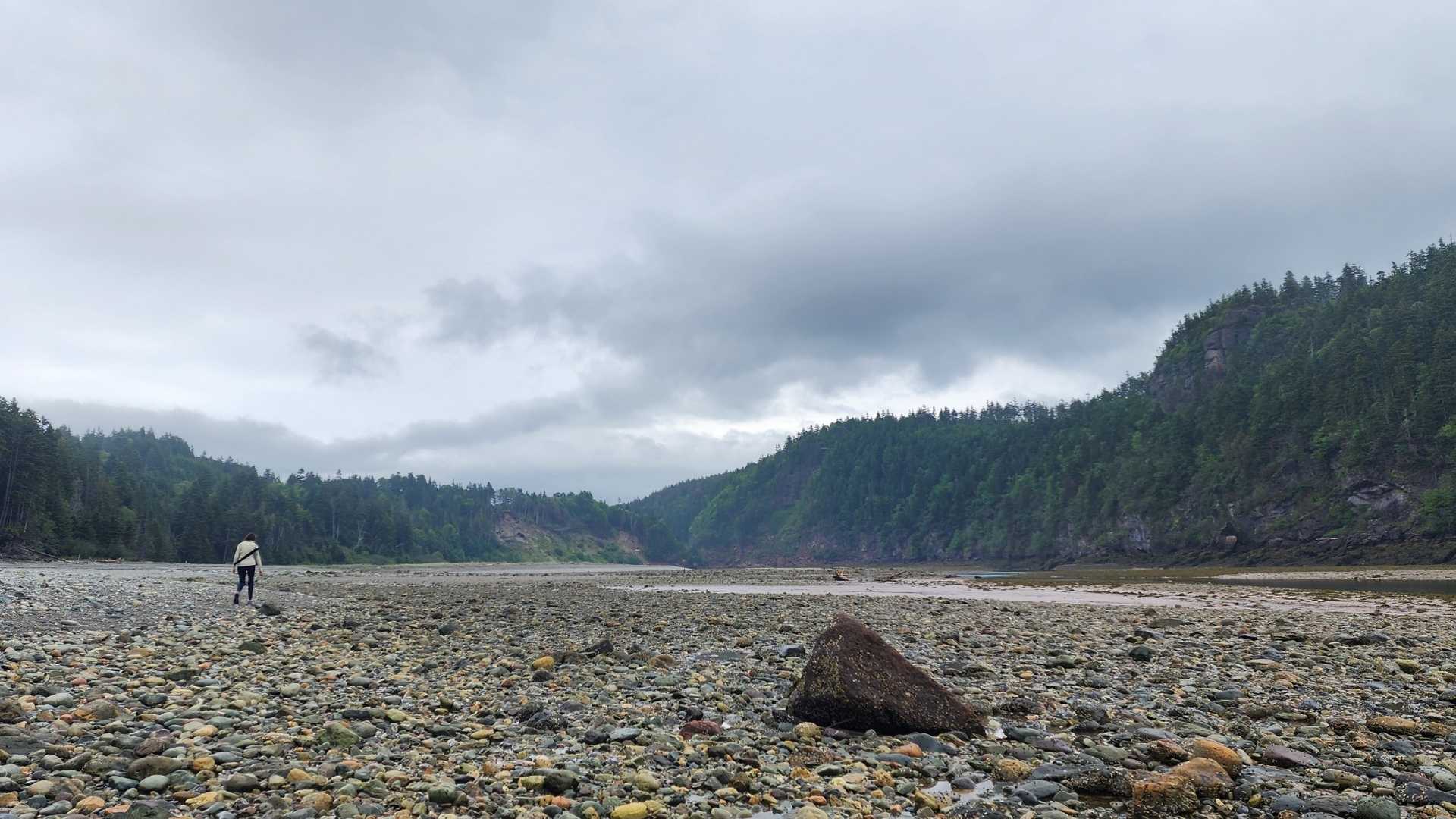
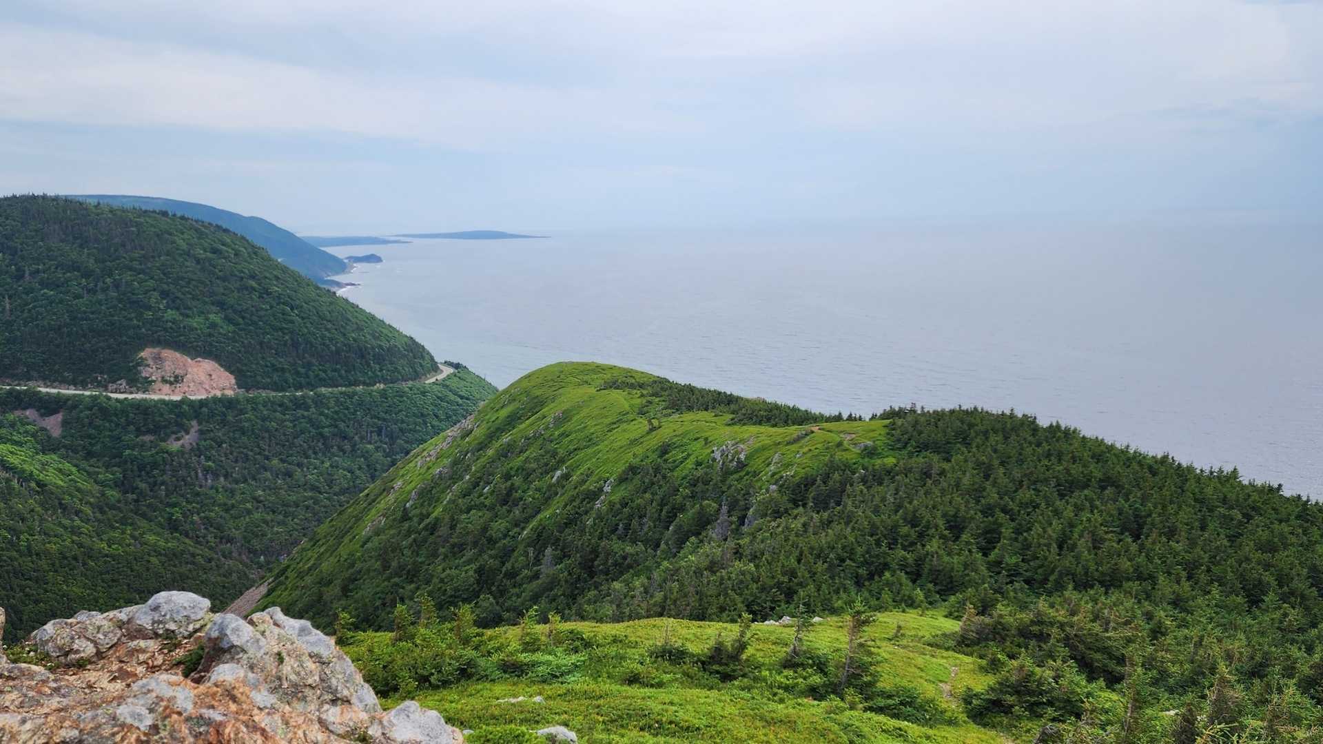
While in New Brunswick and Nova Scotia, we spent eight nights camping in Fundy and Cape Breton Highlands National Parks, each stunning in its own right and very different from each other in geography and geology. Fundy National Park sits along the bay’s protected coastline and, at low tide, exposes miles of underwater boulder fields, sea stacks, and caves. Inland, the park holds slices of Acadian forest, blending northern evergreens with southern hardwoods, and waterfall-filled rivers cutting through its many gorges. Cape Breton Highlands National Park sits at the heart of Cape Breton Island, rising dramatically between the Gulf of St. Lawrence and the Atlantic Ocean to a 1,200-foot plateau that resembles a northern taiga or Arctic tundra, filled with stunted trees, ponds, and bogs. Below, lush Acadian forested valleys hold old-growth stands more than 350 years old, alongside pure sugar-maple groves near the edge of their natural northern range.
While we visited the parks, I spoke with members of the parks’ Resource Conservation Teams about climate impacts they are experiencing. Both noted that climate change is contributing to increased frequency of storm events, such as hurricanes, prolonged droughts, a decrease in average annual snowfall, and a delay in first frost dates. They are both seeing changes in species populations, with some suffering and others flourishing amidst the changes. The parks are also dealing with the increased costs of storm repairs and the hardening and relocation of infrastructure in preparation for rising sea levels and increasing coastal erosion.
One strikingly visible sign of these changes in both parks is the thousands upon thousands of dead spruce trees blanketing the once lush boreal hillsides. The spruce budworm, a native species, is benefiting from the less-harsh winters that would otherwise control its population across the Maritime Provinces, and is devastating the region’s spruce-dominated forests. The spruce needles in the stands of infected trees turn from their beautiful bluish-green to a scorched rust before falling to the ground, leaving nothing but ghostly grey trunks and stiff, barren branches. The landscape’s alteration is happening faster than other plant and animal species can adapt. It is also turning the forests into fire-prone tinderboxes and disrupting the region’s timber industry, a foundational economic and cultural pillar for the Maritime Provinces and a primary economic engine for rural communities.
As a result, provinces have begun spraying pesticides to control what historically has been a natural cycle of spruce budworms thinning less healthy trees without damaging the forest. As the manager of forest health for Nova Scotia’s Department of Environmental Services put it, “As climate change continues to stress our forests and amplify the risks of wildfire and long-term ecological damage, the urgency of maintaining this strategy cannot be overstated.” The dog is chasing its tail.
I had not expected to see such widespread tree death again. As a child, I watched the hemlock-dominated forests of coastal Connecticut die at the hands of the hemlock woolly adelgid. The soft-needled evergreen trees I had loved playing under and climbing up into turned barren and brittle. It became dangerous to be in the woods when the winds blew, with the tops of the dead hemlocks snapping and falling to the ground like spears. A few decades later, I moved to Southern Appalachia just as the woolly adelgid had expanded its range, with the help of a warming climate, southward into the region. Once again I watched the mighty hemlocks fall. Seeing these expansive spruce forests facing the same fate put a lump in my throat.
I asked the park’s staff if they had hope that humanity would act in time to avert the worst impacts of climate change. The staff at Cape Breton said, “Looking ten years ahead, our greatest concern is the pace and scale of change and what that could mean for the park’s ecosystems, cultural resources, and infrastructure, and for the communities that depend on and care about this landscape. At the same time, there is reason for hope. We are seeing communities, scientists, Indigenous peoples, governments, and individuals increasingly recognize the need to act and develop practical solutions.” The staff at Fundy echoed the hopefulness: “Yes, I have hope. I think it’s difficult to choose action and sustain the effort it requires without having hope that we can influence a better future. There is every reason in the world not to give up.”
Setting Sail
I lay in our dark cabin’s bed as the ferry lists and rolls on the stormy seas above the 1,800-foot-deep Laurentian Channel between Cape Breton and Newfoundland; a massive glacially carved submarine valley created 2.5 million years ago when the Laurentide Ice Sheet expanded across North America. The ship’s foghorn has been blowing every 15 minutes for the past five hours. I close my eyes to try to get some rest while we sail through the night.
I awaken and look out our porthole into the unrelenting fog. My watch says 8:00 a.m., so we must be getting close to land. I put on my rain jacket and wool beanie and head up to the sun deck, which I know will be anything but. As I get up to the slippery deck awash with sea spray, the seagulls dart and laugh. Off the starboard, I catch a blurry glimpse of Cape St. Mary jutting out into Placentia Bay. Land ho.
As we get deeper into the bay, the fog slowly peels back its curtain to reveal a lush-green cliff-lined coastline speckled with blooms of pink sheep laurel, orange hawkweed, yellow shrubby cinquefoil and creeping buttercup, purple tufted vetch, magenta beach pea, white sea rocket and Labrador tea. The flowers seem to emanate their own light in the grayness.
The ship’s fog horn blows, echoing off the cliffs rising out of the bay’s still water. The sound startles the nesting seabirds dotting the cliffs. I spot northern gannets, common and thick-billed murres that look like penguins from a distance, black-legged kittiwakes, and, deep in the cliffs’ crevices, razorbills and black guillemots. Great and sooty shearwaters skim across the water looking for breakfast. My head buzzes with excitement. We made it to Newfoundland.
We disembark the ferry and begin our drive across the Avalon Peninsula to the town of Saint John’s before heading south to the Witless Bay Ecological Reserve, where we will spend four days living amongst 2 million nesting seabirds. We drive through the persistent fog and a light misting rain, what Newfoundlanders call misky. Through the misky, the sparse rural landscape looks eerie. We were able to charge the EV to 95% before we got on the ferry, so we’ve got plenty of juice at the moment. Traversing Newfoundland is going to be our biggest charging challenge as infrastructure is scarce. We’ve mapped out our 900-mile route, downloaded the apps we will need to activate various chargers, and purchased a plug adapter for the ones that do not match our EV’s socket. Still, we could run into some problems. But I’m not worried about that yet.
The Shape of the Bet
Newfoundland is a rugged place; its nickname is The Rock. It’s hard to grow food on a rock. Hence, Indigenous peoples, Vikings, and European settlers relied on the island’s exceptional offshore fishing for sustenance, especially its Atlantic cod. Cod’s abundance here was the result of geography. Off Newfoundland’s southeast coast, the seafloor rises into a series of shallow underwater plateaus known as the Grand Banks. Here the cold Labrador Current, sweeping down from the Arctic, collides with the warm Gulf Stream, pushing up from the south. That collision churns nutrients up from the ocean floor into sunlit shallows, fueling blooms of zooplankton that feed schools of capelin, which in turn feed cod, along with Greenland halibut, haddock, saithe, Atlantic salmon, American plaice, and redfish; they also feed many seabirds, including the Atlantic puffin that relies on capelin for up to 95% of its chick-rearing diet.
Capelin are the keystone to one of the most productive food chains in the North Atlantic. Lore has it that when John Cabot first sailed over the Grand Banks in 1497, he reported the sea so thick with fish his crew could lower baskets and pull them up full. For nearly five hundred years, that abundance seemed inexhaustible. It wasn’t.
For nearly five centuries, cod fed the province’s economy and its identity, until it didn’t. By 1992, industrial trawlers and decades of fishing quotas set more by economics than by biology had driven the northern cod population down 99% from historic levels; a decline sharpened by a mysterious, near-simultaneous crash in the capelin population cod depended on for food, one whose cause scientists still can’t fully explain. The moratorium that followed put roughly 30,000 people out of work overnight and emptied entire outport communities that had stood for generations. It was supposed to last two years. It lasted 32 years. Even after three decades of protection, cod still hasn’t recovered to its former abundance, in part because capelin never did either.
In 2024, Canada lifted the moratorium, reopening the fishery over the objections of its own scientists, who had recommended holding the line. Independent assessments now put the odds of the cod stock sliding back into collapse at better than one in two. There is fear that warming seas and climate uncertainty will hinder recovery. The province, it seems, is betting that the water will give more than the science says it likely can.
I recognize the shape of that bet. It’s the same bet we keep making with climate change, the one that left my own community underwater in the wake of Hurricane Helene. We keep reaching past what we’re told the systems can bear, and we keep discovering, too late, where the line actually was.

A Breeding Ground
“What name is the reservation under?” asks the young woman at the roadside check-in kiosk for our puffin tour. I give her my name and credit card, and we head down the gravel road to the dock where the Molly Bawn sits ready to take a dozen of us out to Witless Bay’s Gull Island, Green Island, Pee Pee Island and Great Island, which hosts North America’s largest Atlantic puffin colony estimated at 700,000 birds.
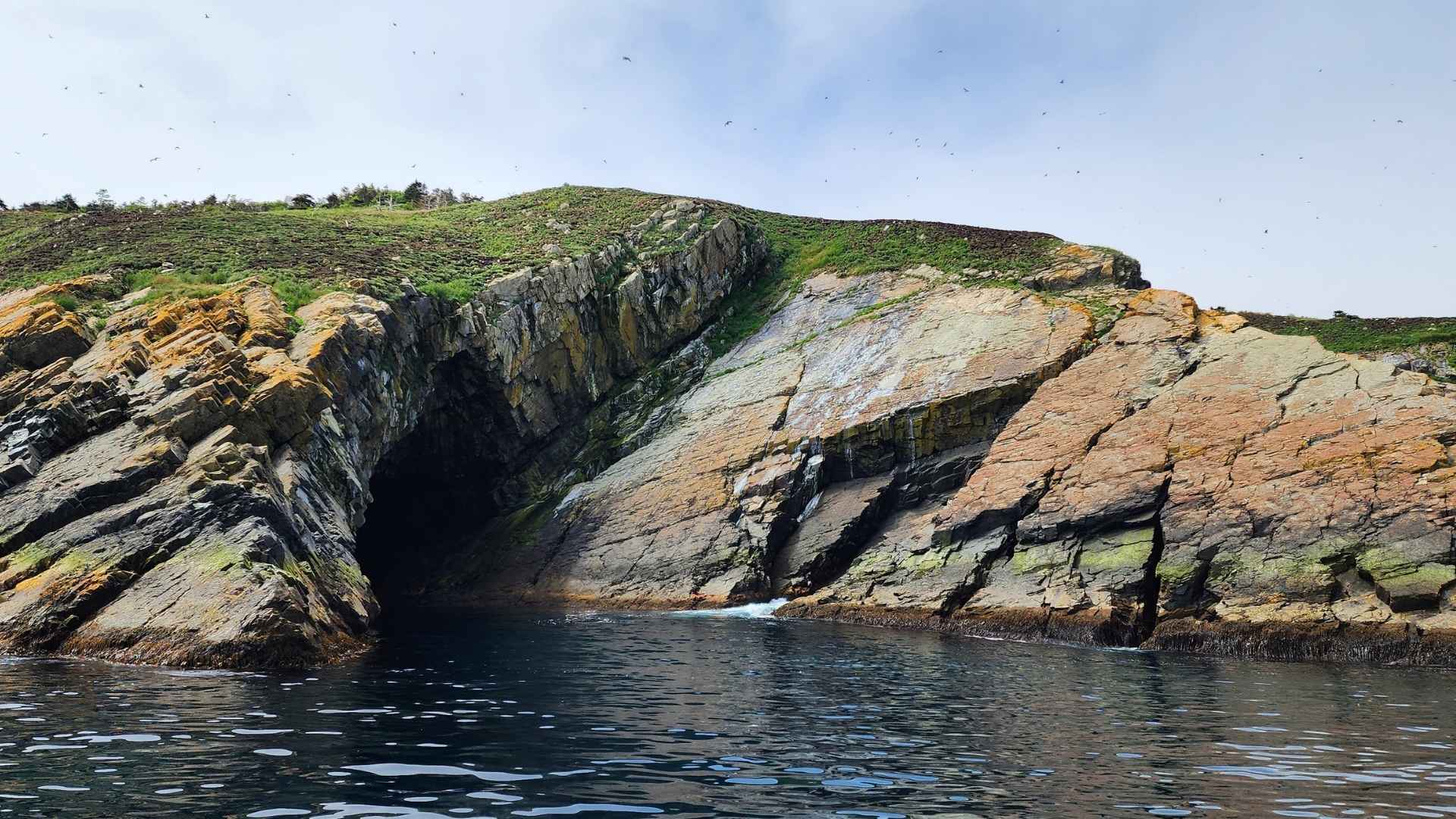
As has been the theme of our Newfoundland experience so far, the fog is thick, heightening a sense of mystery as we pull away from the dock and head into the shrouded bay. After about twenty minutes, we near Great Island. Our noses are the first to tell us we have arrived as the wafts of pungent guano, rotting fish, and ocean brine blow across the bow. Then we see the form of the island emerge, a ghostly mound of interlocking shards of red, green, and grey sandstone covered in coastal grasses, ferns, and flowering ground cover. Even in the fog, the colors are vibrant.
Puffins are everywhere: in the cracks in the rocks, in the water, in their nests in the tall grasses, and in the air, kind of. The onboard biologist lets us know that we are lucky: this year the Labrador Current is running close to Newfoundland’s eastern shore, as it historically does this time of year. As a result, the weather is cool and wet, and the capelin are here in large numbers, which means the puffins are well fed, and breeding is going well. As a result, there are a lot of hungry puffin chicks, or if you like, pufflings, to feed.
By way of example, she directs our attention to the hundreds of puffins floating near the boat, unable to gracefully fly away because their bellies are too full with the capelin they are digesting to regurgitate for their pufflings back at the nest. But while that digestion is happening, the best they can do is skim across the water a few yards to get out of the boat’s way, before settling back on the water and taking a break.
The biologist tells us that if we were here last year, everything would be different: the lush green grasses would be brown, the air hot, the forests dry and on fire, and the puffins hungry. Last year, the Labrador Current stayed far out at sea, allowing warmer water into the coastal shallows, which in turn brought drought; the same drought that caused fires in Nova Scotia and forced our kayak guide, 500 nautical miles away, to shut down for the season.
Without the Labrador Current, there wasn’t any capelin; without food, the puffins failed to breed. There weren’t any recorded fledglings. I asked the biologist what caused the disturbance in the current and what it meant long-term. “From the best we can tell, it’s the result of warming oceans from climate change,” they said. “This year, the colony is bouncing back. If last year was a one-off, they will be fine. But if it becomes a regular occurrence, puffins and all the seabirds here will be in serious trouble.”
They go on to explain that even though the multitudes of seabirds nesting here fly all over the globe when they aren’t breeding, they can only breed here. The islands of Witless Bay provide a unique combination of abundant plankton and forage fish, like capelin, offshore isolation that protects from predation, and a variety of nesting sites including cliffs, forested peat, and grassy slopes. This combination is not available elsewhere on the planet.
I watch the hundreds of thousands of seabirds mating and fledging. The scene feels primal and immutable; surely these birds, which have been doing this for millennia, will continue to do so for millennia to come. But as I listen to the biologist’s warning, I am struck with a sense of fragility and vulnerability. I think about my own climate complicity and feel guilt rise hot in my chest; the last thing I want is for my choices thousands of miles away to disturb the natural wonder unfolding before me. But when multiplied by everyone else’s, they may.
Walking on Earth’s Mantle
After a week on Newfoundland’s east coast, we start our two-day drive to the west coast’s Gros Morne National Park and Long Range Mountains, the northernmost chain of the Appalachian range. Day one goes smoothly; all the chargers work, though we do have to wait in line at one charger for half an hour, which is fine; we aren’t in a hurry. We wake up on day two with only 100 miles left to go. We pull up to the day’s first charging stop and, again, another EV is using the site’s only fast-charging station, with another waiting in line; it reminds me of EV charging back home fifteen years ago, when you never knew what you might find until you arrived. While waiting for our turn, I chat with one of the other EV drivers. They just left the West Coast and say it’s sunny there. Hallelujah. Enough with the misky already.
We arrive at Gros Morne and, sure enough, are greeted by the warmth of sunshine we have not felt in ten days. Gros Morne is a place I have wanted to go since I was fourteen years old, when, in my town library, I picked up a copy of National Geographic magazine with a cover story titled “Canada’s Atlantic Gateway: Newfoundland”. I was mesmerized by the contrasting images of lush 2,000-foot-high fjords adjacent to barren mountain landscapes that looked more like Mars than Earth. I was equally intrigued by the story’s focus: in the late 1960s, the park’s geology unlocked scientists’ understanding of plate tectonics and how the continents were formed. And now I am seeing it with my own eyes.
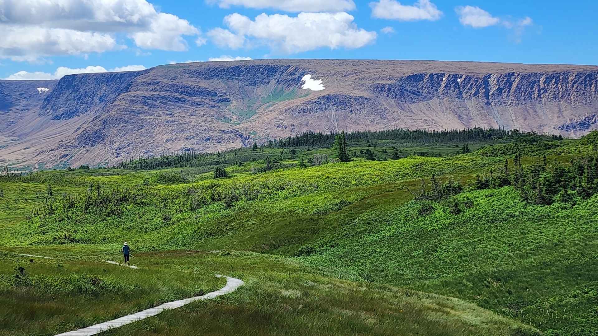
Eager to get out of the car and on the trail, we drive to the Tablelands. In these barren, otherworldly mountains, Earth’s mantle was pushed to the surface when the ancient continents of Laurentia and Gondwana collided around 460 million years ago, forming the Appalachian mountain chain, which, at the time, is estimated to have been 25,000 feet tall. We lace up our boots and hike out onto the rust-orange rock-covered landscape. Walking across the rocks, the sounds under our feet are foreign: metallic crunching and the clink of shifting scree.
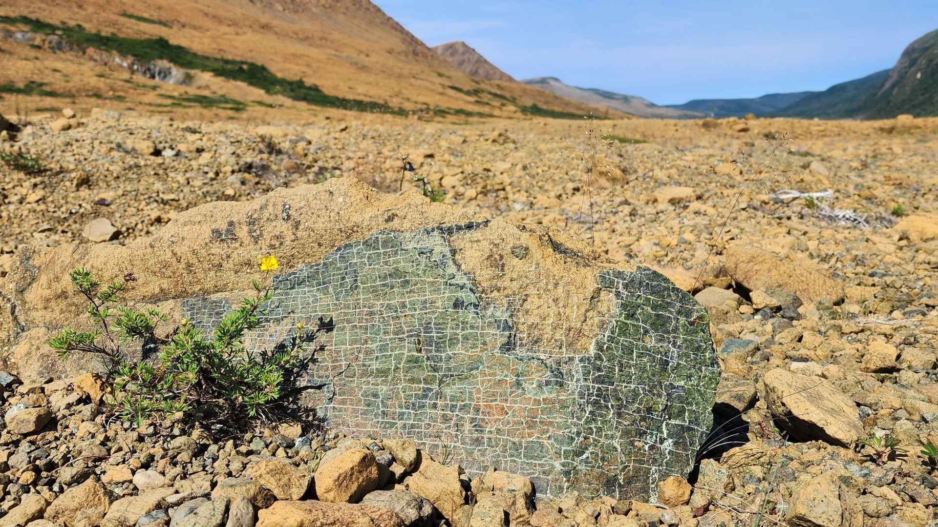
I take notice of how little is growing on the rocks. A ways up the trail, an interpretive sign explains why: the Tablelands are barren-looking because they are made of peridotite, a toxic rock from the Earth’s mantle that lacks essential nutrients like calcium and nitrogen and contains high levels of heavy metals. But it’s not completely barren. Carnivorous pitcher plants and butterwort, bog rosemary, and half a dozen rare Arctic and alpine plants can exist here by drawing nutrients from things other than the soil. Same with the bonsai-like juniper and spruce trees growing horizontally and low to the ground to avoid the wind. Their adaptations and resilience are remarkable.
I bend down and pick up a softball-sized piece of mantle rock, one of a gazillion around us. Its heaviness surprises me; I feel like I am curling a fifteen-pound dumbbell. I look up to the ridgeline high above and the weight of the mountain suddenly feels massive. Like when I was a kid imagining the ice sheet moving towards my doorstep, I close my eyes and imagine the force our planet possesses, a power so strong it pushed this mountain from deep down in the mantle to here beneath my feet.
Where Do We Go From Here
I am no closer to answering the question of where we go from here than I was when I left for this trip. I didn’t expect to be. That would have been too easy. I recall the conversations I’ve had along the way with scientists, tour guides, park interpreters, researchers, EV drivers, campground neighbors, and a psychiatrist on the bar stool next to me. I am left feeling that we are all in the same boat, out at sea, and no one knows how to navigate by the stars.
What is clear to me is that climate change is a symptom of a much deeper problem plaguing humanity. Our pollution of the atmosphere is tied to our dwindling respect for nature and its cycles, and to our centuries-long reduction of nature’s beauty, wonder, and life-sustaining systems to commodities: forests are board feet of lumber, tall-grass prairies are farm fields, oceans are fisheries, mountains are mines. As long as humans view nature as something to transform into products and prosperity without regard for the impact upon nature, we are going to struggle to solve the climate crisis and all the other environmental problems we face.
At the same time, climate change is exposing the flaw in our people-centric worldview; we will struggle to thrive if the planet’s climate stability, which has endured throughout our evolution, is replaced by climatic chaos. Already some of our systems are under strain. In the US, as storm-related insurance losses climb sharply, insurers are retreating from climate risk-exposed regions, undermining the financial security of homeowners, renters, and the broader economy. America’s agricultural sector is also being impacted, with rising temperatures alone adding $27 billion to US crop insurance losses between 1991 and 2017. Meanwhile, worldwide, weather-related disasters have displaced an average of 22 million people a year since 2008, creating localized humanitarian crises and fueling unrest and a political backlash against migrants. And then there are the mounting ecological damages, the costs of which we don’t yet fully understand, like ocean acidification, coral reef collapse, biodiversity loss, pest and pathogen expansion, permafrost thaw, declining snowpack; the list goes on.
As we break the inertia of our road trip and turn the EV southward to head home, I want to believe we’ll exit the fossil fuel road before it’s too late. The technology to do it – wind, solar, storage, EVs – is already sitting in front of us, proven and waiting; I’ve just driven my EV 3,500 miles of a 5,000-mile road trip without producing any tailpipe pollution and without a hitch. But I am concerned that the inertia of our fossil-fueled economic and political systems is like what Newfoundlanders call the Wreckhouse wind: fierce, strong, and capable of knocking things down. And it is blowing now. Perhaps its last gasp. I hope so. Because after spending a few weeks with Earth’s raw power – Bay of Fundy tides, Labrador current, mantle thrusted through the crust – it’s clear to me that provoking the planet’s propensity for chaos while betting that some future breakthrough will save us before the bill comes due is a risk we can’t afford to take.


