State Energy Offices across the Southeast collaborated on an electric vehicle infrastructure planning tool to guide equitable charger deployment.
Guest Blog | December 27, 2021 | Clean Transportation, Electric Vehicles, Energy JusticeThis blog post was written by SACE’s former Electric Transportation Equity Manager, Patrick King.
Earlier this year, several Southeast State Energy Offices (SEOs) came together to launch the Southeast Regional Electric Vehicle Information Exchange or SE REVI. Take a look and explore the map here. The exchange is a mapping tool that supports multi-state coordination on EV infrastructure (EVSE) investments by identifying charging station gaps along priority corridors. Participating SEOs include Alabama, Arkansas, Florida, Georgia, Kentucky, Mississippi, North Carolina, South Carolina, Tennessee, and the territorial offices of Puerto Rico and the US Virgin Islands.
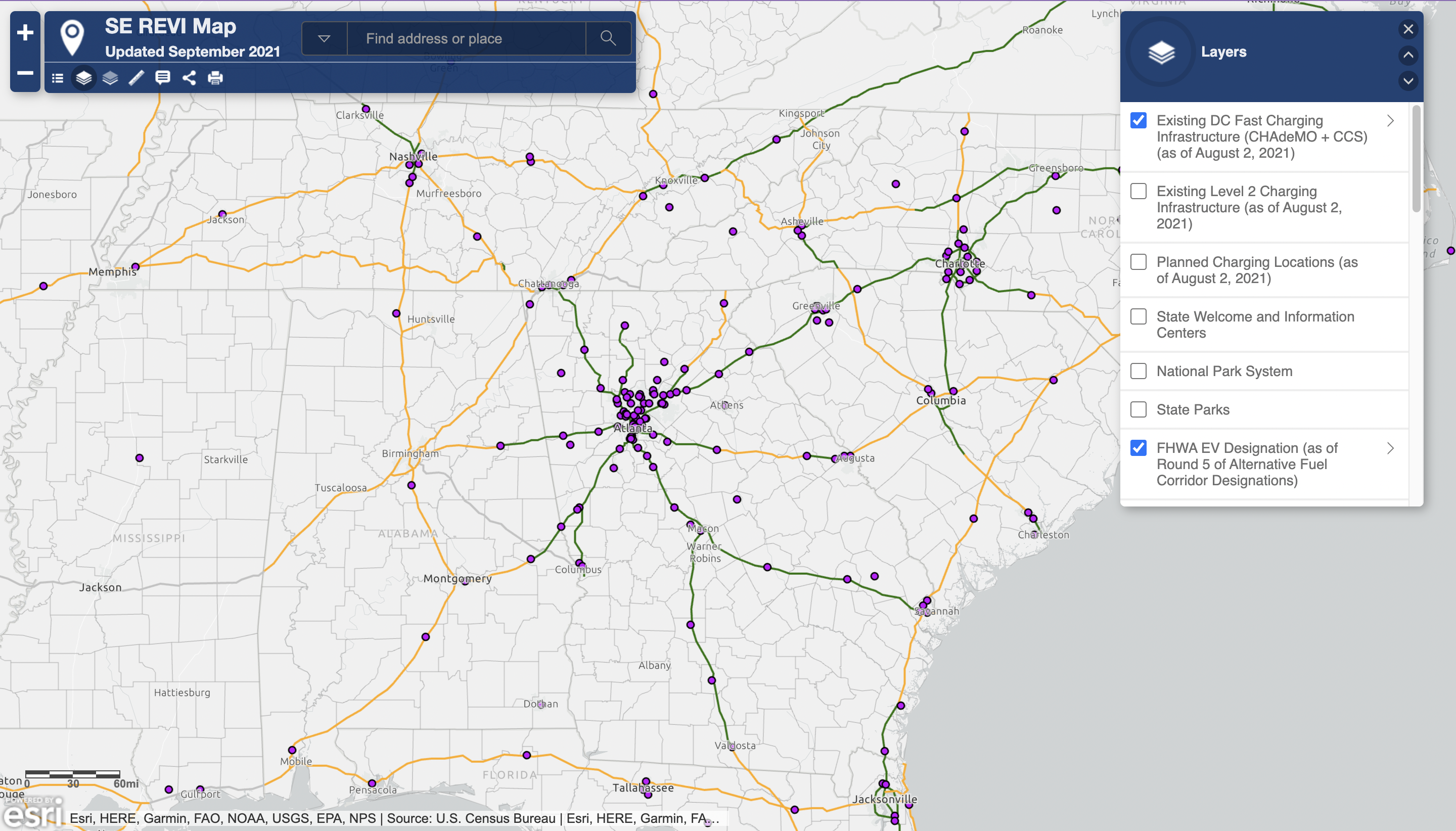
The information exchange was founded in late 2020, and the subsequent map was developed to support and expand information sharing on EVSE planning, development, and program implementation. The platform, developed by Energy Analyst Mark Finlay of the Tennessee Department of Environment and Conservation (TDEC), builds on existing public data and incorporates a variety of additional data layers from other state offices. Updated quarterly, the mapping tool serves to inform a wide variety of decision-makers such as representatives of power companies, private businesses, and local municipalities.
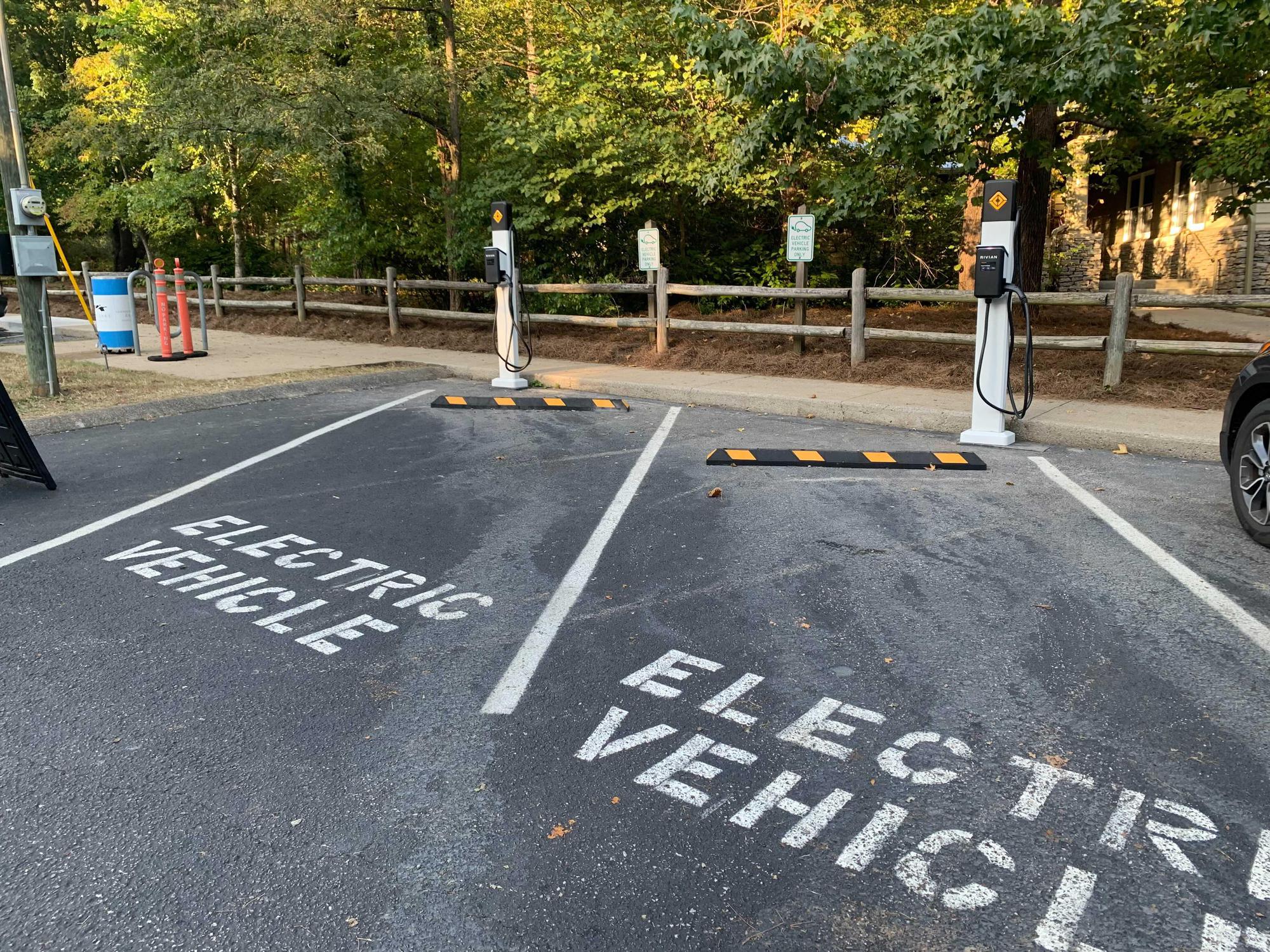
Existing data include current and planned Level 2 and DC fast chargers, state welcome centers, designated Alternative Fuel Corridors, hurricane evacuation routes, electric utility territories, and parks information. The inclusion of National and state parks provides a great use case example for EVSE placement as visitors typically spend a few hours in these locations and, in doing so, support the parks themselves.
Additionally, the map includes several layers that can inform EVSE investment on a holistic basis. The two Ozone and PM2.5 & High Ambient Diesel PM Concentration layers help identify counties with poor air quality that could be targeted for potential investments. Additionally, there are several layers relating to social equity including vulnerable age groups, homes where English is spoken as a second language, minority communities, and the percentage of the county population living under the poverty line. We know that due to unequal land-use patterns and discriminatory policies some communities – mostly lower-income and communities of color – are oftentimes burdened with additional pollution and health impacts. The inclusion of these in-depth datasets highlights the benefits that electrified transportation can bring to historically underserved communities.
With billions in funding coming from the federal government, it’s essential that states coordinate on EVSE placement to ensure that no communities are left behind and that infrastructure is in place to meet growing demand. If you have any feedback or are interested in adding additional data layers, please reach out to Mark Finlay.
Electrify the South is a Southern Alliance for Clean Energy program that leverages research, advocacy, and outreach to promote renewable energy and accelerate the equitable transition to electric transportation throughout the Southeast. Visit ElectrifytheSouth.org to learn more and connect with us.